Results 1 to 10 of 227

Thread: Most beautiful temple in India

Hybrid View

Previous Post Previous Post   Next Post Next Post
  1. #1
    Join Date
    Sep 2006
    Location
    Kerala, India
    Posts
    17,476

    Default Chardham Yatra - Badrinath

    Badrinath - Hindu pilgrim centre (300 km from Rishikesh, 12 hour, 3100 m), hot springs : Taptakund and Surya kund (550C), from temple steps leads to Charan paduka. The last village Mana is at 3 km. Vyas gupha : cave, trek to Vasudhara falls via Bhim pul (5 km, 122 m water fall at 3658 m). The route leads to Mt. Nilkantha (6596 m, 10 km). Mt. Kamet (7756 m). China border is just 15 km away.

    Tapt Kund

    This kund has a natural hot water on the bank of Alaknanda River where visitors take a bath or get refresh before going to temple. Assumed to be instilled with curative chattels, Tapt Kund is also measured to be sacred knowledge.

    Charanpaduka

    It is a beautiful meadow on which footprints of Lord Vishnu are visible (From back side of the temple steps leads to Charanpaduka). It is a stunning pasture on which footprints of Lord Vishnu are observable. The fast moving clouds below is a great scenic sight.


    Above Badrinath, a route leads to the Base of Mt Nilkantha.

    Road route : Rishikesh - Devaprayag - Srinagar - Rudraprayag - Karnaprayag - Nandaprayag - Joshimath - Badrinath.

  2. #2
    Join Date
    Sep 2006
    Location
    Kerala, India
    Posts
    17,476

    Default Trekking in Uttarakhand

    PINDARI - KAFNI GLACIER - Bageshwar to Song by bus (40 km, 1400 m). Trek to Dhakuri (14 km, 2680 m) via Loharkhet, to Khati (2210 m, 8 km), to Dwali (2576 m, 11 km), (a) to Pindari glacier (3353 to 4625 m) via Phurkia (8 km, 3260 m) : 6 day trek. (b) Kafni glacier (13 km, 3800 m) via Byaligar. All places have dak bunglows. Executive Engr PWD Almora is the reservation authority. Season : May/June.


  3. #3
    Join Date
    Sep 2006
    Location
    Kerala, India
    Posts
    17,476

    Default Trekking in Uttarakhand

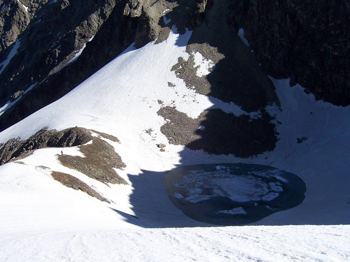
    ROOPKUND LAKE (5030 m, also known as the 'Mystery Lake') - Bageshwar to Gwaldam and then to Debal (45 km) by bus. Travel by jeep to Mandoli and then to Wan. Wan to Bedni Bugyal (3350 m, 14 km) : 6 hour. Bedni Bugyal to Bhagwa Basa (4100 m, 5 hour). Then to Roop Kund and back : 100 km , 5 days. Lake is at the foot of Trishul (7122 m) peak. A 30 min further climb take one to Zorawar Gali (5350 m) with great views of glacier and Mt Trishul. The route further steeply climbs down to Homkund, the Nandadevi Jat Yatra route (2012 AD).


  4. #4
    Join Date
    Sep 2006
    Location
    Kerala, India
    Posts
    17,476

    Default Trekking in Uttarakhand

    MILAM GLACIER (4267 m, length of 27 km and 3 km width) -Bageshwar to Martoli by bus. Trek to Milam glacier (20 km).


    SUNDERDUNGA GLACIER
    - Bageshwar to Song by bus. Trek to Dhakuri via Loharkhet (14 km), to Jatoli via Umla (15 km), to Kathalia (3206 m) via Dungiadong (13 km), (a) to Sunderdunga glacier (7 km, 3800 m) : 7 days. (b) to Sukhram glacier (7 km, 3900 m). (c) Maiktoli glacier (7 km, 3800 m). Tharkot (6100 m), Mrigthuni (6856 m), Maiktoli (6804 m) and Pawali Dwar (6663 m) are nearby peaks.


    KHATLING GLACIER/MASARTAL LAKE - Tehri to Ghuttu via Ghansali (63 km). From Ghuttu (1524 m) trek to Reeh (2132 m, 10 km), to Gangi (2584 m, 10 km), to Kalyani (2683 m, 5 km), to Bhelbagi (3110 m, 13 km), to Khatling (3717 m, 7 km), to Masartal (3675 m, 6 km).

    Dodi Taal Lake : A stunning addition of water placed at an elevation of 3024 m above the deep level. Bounded by an opaque jungle of deodar, oak, rhododendron and pine, sports look primordial woodland. Base point : Kalyani.

  5. #5
    Join Date
    Sep 2006
    Location
    Kerala, India
    Posts
    17,476

    Default Trekking in Uttarakhand

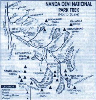
    NANDADEVI SANCTUARY - A UNESCO world heritage centre with Mt. Nandadevi (7817 m, India's second highest peak). Joshimath - Malari (70 km) road goes through Tapovan, Reni, Lata (25 km) and Juma. (a) From Malari trek to Niti village (5038 m). (b) Trek from Lata to Dharansi (4250 m, 17 km) and then to Nandadevi sanctuary (40 km) with permit. Joshimath is on the Badrinath road having good accommodation facilities.


  6. #6
    Join Date
    Sep 2006
    Location
    Kerala, India
    Posts
    17,476

    Default Trekking in Uttarakhand

    Kalindi Khal trek (5900 m) : One of the highest and tough treks in Indian Himalaya from Gangotri to Badrinath over Kalindi Khal glacier. Permit required for this 10 day tough trek. Season : May/Sept


  7. #7
    Join Date
    Sep 2006
    Location
    Kerala, India
    Posts
    17,476

    Default Trekking in Uttarakhand

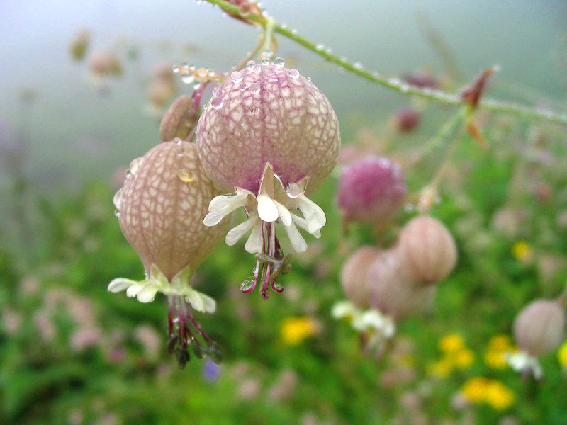
    VALLEY OF FLOWERS (3658 to 3962 m) - A world heritage centre and the only flower national park in India with variety of flowers, discovered by Frank Smythe. Season - July to August. Govind ghat (1828 m, 18 km after Joshimath on Badarinath road) to Ghanjhira (3048 m, 15 km, Gurudwara/Rest house) by trek. Trek 5 km to Valley of flowers. Take permit from Govind ghat. HEMKUND/LOKPAL (4329 m) : Sikh Pilgrim centre, 6 km trek from Ghanjhira. Lakshman temple and lake.


Bookmarks

Posting Permissions

  • You may not post new threads
  • You may not post replies
  • You may not post attachments
  • You may not edit your posts
  •