-
 Rock climbing in India
Rock climbing in Sahyadri, Maharashtra
Dahanu : Mahalaxmi pinnacle
Kalyan : Haji Malang, Harihar & Fani Dongar, Lingi
Malshej : Bhairavgad
Panvel : Kalavantin from Prabalgad, Karnala, Irshal
Karjat : Chanderi, Machindragad, Mhasmal, Padar Killa
Lonavla : Bhairi cave & pinnacle, Moradi pinnacle, Telbaila
Pachad : Lingana pinnacle near Raigad fort
Chiplun : Prachitgad
Igatpuri : Madangad, Alang, Dangya, Shenit pinnacle, Ghodishep, Napta
Nashik : Dhodap, Avandh, Ikharia pinnacle
Manmad : Hadbi chi Shendi pinnacle, Koldher, Chandwad fort
Satana : Tambolya, Mangi Tungi, Salota, Takara
Rock Climbing Areas : Himalayas in Kashmir, Himachal Pradesh and Uttaranchal, Aravallis near Delhi, Mt.Abu and Sariska in Rajastan, Pachmarhi in Madya Pradesh, Sahyadris near Pune, Chamundi hills and area around Bangalore - Mysore Highway.
-
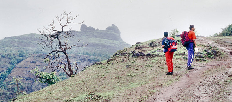
 Irshal (Vishalgad, 370 m), Panvel
It has a peculiar forked shape with sharp ridges and a prominent hole in the centre. Reach Chowk from Panvel or Karjat. A 3 km uphill track leads to Vishalwadi at the foot of the final climb. From the village the route lies over the extreme left ridge in the northerly direction and then from behind the hill to a small gap above the hole. Straight ahead is a 10 m rock climb to the loose scree above. A very exposed scree traverse from the left leads to the small grassy top. One should be very careful on descent, as any slip would be difficult to check.
It is not advisable to climb the final grassy top of Irshal without experience and ropes. A few people have died on these final slopes.

-
 Prabalgad fort, Panvel
Prabalgad is a fort located in between Matheran and Panvel at 770 m. The fort lacks water source. This fort was conquered by Shivaji from Mughals in 1658.
Panvel to Thakurvadi by six-seater auto-rickshaw(14 km) near Apollo Nusi Research Centre. Trek to the fort following cart track. One hour trek takes one to forested higher plateau called Prabalmachi inhabited by tribals. Trek to the fort takes 4 hour. Descending takes 2 hour.
Kalavantin view from Prabalgad

-
 Karnala fort (469 m), Panvel
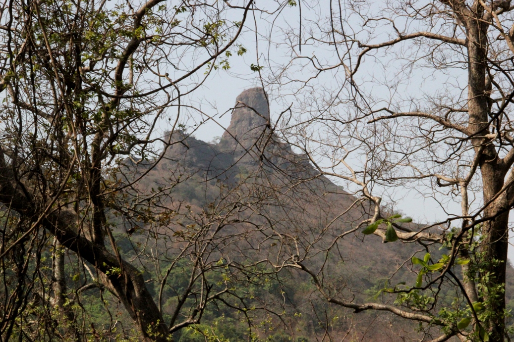
The funnel shaped pinnacle of this fort stands prominently on the Panvel - Pen road (10 km). Thickly forested, the area has been declared as a bird sanctuary. Reach the base of the funnel by a man-made route, which is easy to climb in a hour. The 45 m thumb shaped funnel rises steeply with caves at its base.
For those trained in rock climbing and with proper equipment the final pinnacle offers excellent opportunities for rock climbing from the eastern side. To avoid the heat, the climbing should be started very early in the morning or late in the afternoon. The rock is fairly firm, but one should be wary of scree and the bees. The top commands a grand view and in
clear weather the Mumbai harbour is visible. While descending it is possible to rappel with a firm tree as an anchor. The fort walls are excellent for practicing artificial rock climbing.
-
 Prachitragad (971 m), Chiplun
Location : Chiplun / Kolhapur in Maharashtra, India. Fort in dense forest in the Warna area.
Route 1 : Travel from Chiplun - Sangameshwar-Nyari by ST bus. Trek to Shringarpur (3 km) - climb to reach a white spot on cliff (6 km) - traverse towards north and climb the north col to get to Darwaza of fort (1 km) - temple, water tanks and old gun. One has to cut the route through the dense forest as it is not visited frequently. The route is exposed at various places.

Route 2 : Travel from Ratnagiri or Kolhapur to Ambe. Then to Udgir - Chandel - Rundiv by ST bus (50 km from Ambe). The 15 km long Chandel - Rundiv road is through forest. Prachitgad is one hour trek away from Rundiv village. In the north is Patharpunj (13 km from Rundiv by trek, dense forest worthy a visit with a guide, sada - volcanic fields).
One can descend to Nyari in Konkan (13 km trek) and travel to Sangameshwar.

Sada
-
 Dhodap fort (1451 m), Nashik
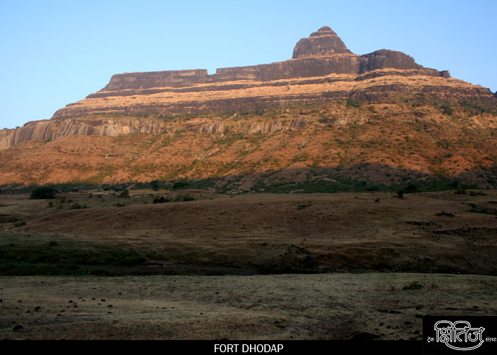
Dhodap is a very prominent fort. From Nashik take a bus to Vadalibhoi naka (30 km) on the Chandwad road. Travel to Hatti via Dhodambe (11 km) by truck or ST bus. There is a direct bus to Hatti from Nashik, reaching Hatti at 8 pm. One can stay at the Hatti temple. Approach the base of the fort's pinnacle and climb to the upper plateau. A hut and few (3) temples are located at Sonar's village. Climb the route to top where one can see excellent caves (3), water ponds (10) and a commanding view of the hills. The final rock pyramid is still 70 m higher with a rock climbing route on the ridge.
On the western ridge of Dhodap, a wide gap is hewn out - to throw the condemned prisoners. A sadhu lives below the pinnacle in a cave on the fort. On top, there are around 10 water cisterns, 3 caves, ruined palaces and a tunnel cum cave.
Fine views of Ikharia pinnacle, which is on the adjoining common plateau. The to and fro trek takes 3.5 hour.
Enjoy the fresh air and peace ......

-
 Ikharia pinnacle (1158 m), Nashik
It is near Dhodap fort and is of purely rock climbing route. From Sonar's village a flat walk via fort's entrance leads to Gorakhnath ashram at the base of the pinnacle. The route up is through a prominent slanting Chimney. From Ikharia climb down to Kondana and then to Dhodambe (6 km).
-
 Avandh (1319 m), Nashik
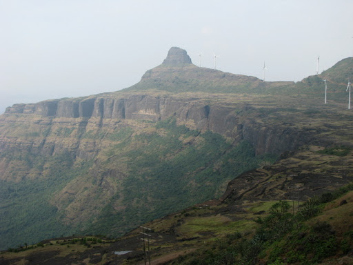
Avandh is a prominent huge rock massif, standing next to Patta fort. It has huge walls and a narrow summit. The steps to the top are blown off and, at many places, one has to resort to rock climbing. This peak was probably used as a watch tower.
Avandh is best approached from Ninavi (Nashik to Girwadi by bus and trek to Ninavi). A track leads to the base of the rocky massif, from where the rock climb starts. At the top one discovers a small cave and a fantastic view of Patta fort.
Or Igatpuri to Taked by 1145 h bus. Travel to Adsure dam (30 km) and trek to Pattawadi.

-
 Harihar fort (1120 m), Trimbak
Harihar is a unique fort in the Sahyadris, built on a triangular prism of rock. Its three faces and two edges are absolutely vertical. The third edge is inclined at an angle of about 75 degree. A one meter wide rocky staircase is hewn on this range. At one place, it goes through a hole, carved in rock. The rocky staircase has good fingerholds, so it is an easy and interesting climb. On top, there is a small temple, a shelter, a rocky hill with an easy route to top and 16 water tanks. One can stay a night at this shelter/room, which is in good condition.
The British officer Capt. Briggs described it as wonderful route and wrote : 'Words can give no idea about its dreadful steepness. It is perfectly straight for, I suppose 200' and can only be compared to a ladder over a height of this nature'. This was one of the forts surrendered by Shahji from Bijapur control to Mughal general Khan Zaman of forces of Shajahan. It surrenderd to the British in 1818 after the fall of Trimbak.
Khodala, Jawahar and Mokhada are tribal (Adivasi) dominated area situated amidst of mountainous country with forested areas. Drivers of this zigzag route drive leisurely with caution. The dress is of special interest - special type blouse and a red scarf with white dots are commonly used. Every village has its own deity and night long pujas/bhagans followed by animal sacrifice is still practised here. Evening time is for enjoyment with home made (desi) liquor.

Travel to Kasara from Kalyan by train (1 hour) and then to Khodala (31 km) by jeep. Appraoch the base village Nirgudpada via Devgon phata (24 km) by Trimbakeswar jeep. From Nirgudpada climb the connecting ridge coming from Fani Dongar - Harihar fort plateau. The to and fro trek takes 3 hour. Bus service is infrequent on Khodala - Trimabk route. Trimabk is 21 km from Nirgudpada.

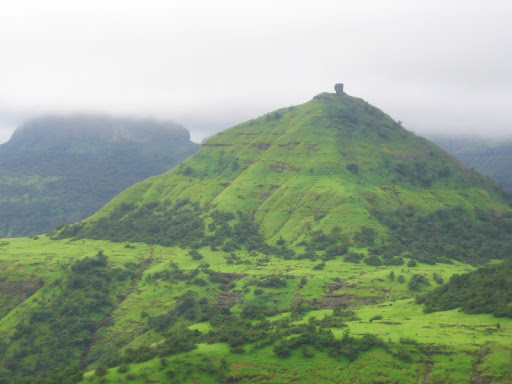
Fani Dongar (992 m) a triangular hill with a 30 m cobra like projection (difficult to climb), located near Harihar fort.
-
 Haji Malang (790 m), Kalyan
Haji Malang is a popular pilgrim centre near Kalyan. Sundays will be crowded with public. This is a prominent landmark in the vicinity of Kalyan, with the dargah of Baba Malang halfway up the mountain. Buses ply regularly from Kalyan to the foot of the hill from where a broad path leads to the Dargah.

Above the dargah there are plenty of opportunities for rock climbing. For the experienced, the route ahead is worth trying. The summit is known as 'Balahasner' and is steep climb from the tomb. There is a hollow at the foot of the rock which towers precipitately in front. Climb is almost perpendicular and is exposed. A steep flight of rock steps leads to the top via a rope bridge and you see a big black hole, which as per legend, was a secret passage to the valley. There are many pinnacles on the summit ridge. One has to be very careful to move around and on the descent.

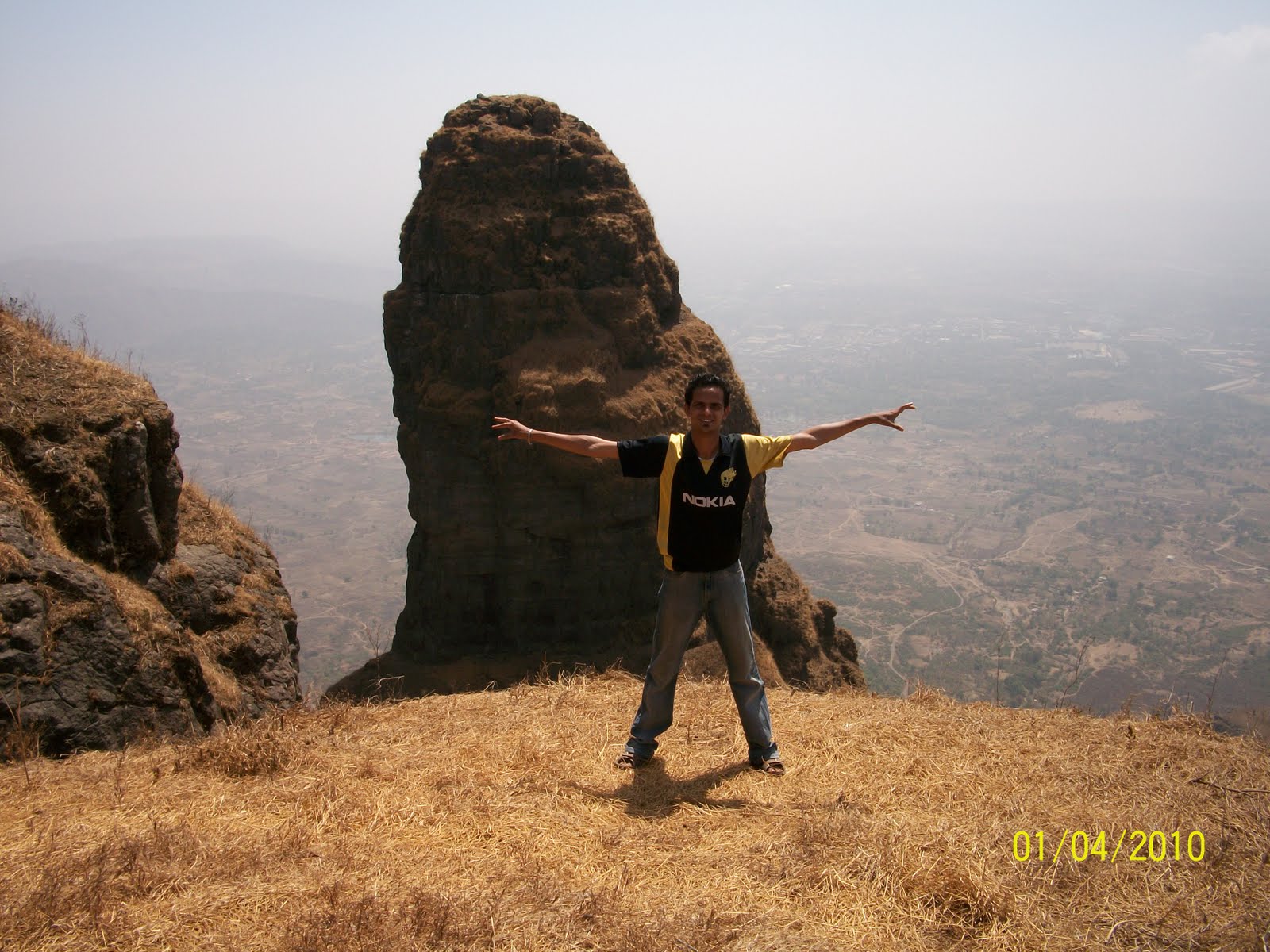
On top of Haji Malangad with pinnacle view
From the back side of the Darga a route leads to Dadi Mam ki darga (10 km one way, 6 hour trek), Kamli Shah Darga (a small cave near the Haji Malang darga), Palki Bogda (a large hole in the main rocky ridge where people paste coins to get their wish fulfilled) and further at the end of the ridge is the Paanch Pir darga (5 saints tomb). From here a very exposed steep route climbs down to the road head. Experienced people can make a try with a walking stick.
Tavli hills (800 m), a group of three pinnacles, is nearby. Tavli caves at the base of the pinnacle can be reached by a tricky and exposed traverse.
The Urs (death anniversary of the saint) was celebrated on 21 Feb 2008. Darga serves free food to the poor. Near the darga one can stay in basic lodges. Few restaurants serves food too (Rs 35 for Rice plate). One can try jumbo paratha and Halwa at Rs 15 (250 g). Mutton and chicken are also available. The prices are little high due to the remote location.
Just before the darga, a route climbs to the base of the steep rock wall (Bala Ansar point, Rs 2). On left, there is a tea shop which sells biscuits and other food items. From there one can climb to the higher plateau via a steep rock cut staircase. A little fortification is on top (a gateway). From here one can have great views of Dadi Mam ki darga, Chanderi fort and the Haji Malang range and Darga. Traverse the left side of the rock wall to reach the rocky staircase.
The real adventure starts from here. The climb leads to a slanting pipe bridge (4 metre long), where one have to walk over it with the help of an overhead rope. One person is on duty (fee Rs 15) will help you to cross the rope bridge by hooking you with a safety rope. The narrow route further climbs to the top. Excellent views of the surrounding area including the pinnacle of Haji Malang. Take extra care while climbing down. The climb from the Haji Malang darga to top and back takes 3 hour.
A morning climb will be nice. Don't feed or tease the monkeys on the way. Carry water for drinking. Wear shoes/sandals having good grip. Avoid carrying items to free both hands. Don't hurry on the route. Warning : No misplaced steps, no excuses, defaulters will be punished with death !.
How to Reach : Travel to Malangad (70 km from Mumbai) by bus from Kalyan (Rs 10, 1 hour). Trek to darga (tomb) of Haji Malang (2 hour, Rs 2 passenger tax). The route is having a number of shops for refreshments.
My route to Haji Malang : Travel to Vavanje by bus from Panvel. Cemented steps leads to Navdurga temple (an ancient Hindu temple with a deep well) near the darga of Haji Malang. The Malangad is visible to a long distance. Above the darga, a thrilling climb takes you to top of the pinnacle via rope bridge. To and fro trek takes 6 hour.
 Posting Permissions
- You may not post new threads
- You may not post replies
- You may not post attachments
- You may not edit your posts
-
Forum Rules


 Reply With Quote


Bookmarks